


Voting District 0002, El Paso County, Texas
About
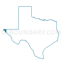
Outline

Summary
| Unique Area Identifier | 672803 |
| Name | Voting District 0002 |
| County | El Paso County |
| State | Texas |
| Area (square miles) | 34.50 |
| Land Area (square miles) | 34.49 |
| Water Area (square miles) | 0.01 |
| % of Land Area | 99.97 |
| % of Water Area | 0.03 |
| Latitude of the Internal Point | 31.94888600 |
| Longtitude of the Internal Point | -106.52806900 |
Maps


Graphs
Select a template below for downloading or customizing gragh for Voting District 0002, El Paso County, Texas


Neighbors
Neighoring Voting District (by Name) Neighboring Voting District on the Map
- Voting District 0001, El Paso County, TX
- Voting District 0003, El Paso County, TX
- Voting District 0005, El Paso County, TX
- Voting District 0011, El Paso County, TX
- Voting District 0013, El Paso County, TX
- Voting District 0041, El Paso County, TX
- Voting District 0052, El Paso County, TX
- Voting District 0170, El Paso County, TX
- Doña Ana County Precinct 74, Doña Ana County, NM
Top 10 Neighboring County Subdivision (by Population) Neighboring County Subdivision on the Map
Top 10 Neighboring Place (by Population) Neighboring Place on the Map
- El Paso city, TX (649,121)
- Canutillo CDP, TX (6,321)
- Anthony town, TX (5,011)
- Westway CDP, TX (4,188)
- Vinton village, TX (1,971)
Top 10 Neighboring Unified School District (by Population) Neighboring Unified School District on the Map
- El Paso Independent School District, TX (327,212)
- Gadsden Independent Schools, NM (62,675)
- Canutillo Independent School District, TX (27,218)
- Anthony Independent School District, TX (5,178)
Top 10 Neighboring State Legislative District Lower Chamber (by Population) Neighboring State Legislative District Lower Chamber on the Map
Top 10 Neighboring State Legislative District Upper Chamber (by Population) Neighboring State Legislative District Upper Chamber on the Map
Top 10 Neighboring 111th Congressional District (by Population) Neighboring 111th Congressional District on the Map
Top 10 Neighboring Census Tract (by Population) Neighboring Census Tract on the Map
- Census Tract 102.16, El Paso County, TX (7,035)
- Census Tract 102.21, El Paso County, TX (6,752)
- Census Tract 102.15, El Paso County, TX (6,597)
- Census Tract 102.14, El Paso County, TX (6,440)
- Census Tract 18.02, Doña Ana County, NM (6,354)
- Census Tract 102.13, El Paso County, TX (5,740)
- Census Tract 102.03, El Paso County, TX (4,732)
- Census Tract 102.20, El Paso County, TX (4,459)
- Census Tract 102.11, El Paso County, TX (2,930)
- Census Tract 102.22, El Paso County, TX (2,175)
Top 10 Neighboring 5-Digit ZIP Code Tabulation Area (by Population) Neighboring 5-Digit ZIP Code Tabulation Area on the Map
- 79912, TX (77,161)
- 79932, TX (24,986)
- 79934, TX (19,174)
- 79835, TX (12,690)
- 79821, TX (7,142)
- 79911, TX (1,565)